Ubiquiti LAP-GPS LiteAP GPS
Buy Ubiquiti LAP-GPS in Kenya from Orbitlink Solutions. 5 GHz airMAX AC sector AP with GPS synchronization, 17 dBi antenna, Gigabit Ethernet and 450+ Mbps throughput.
Ubiquiti LAP-GPS in Kenya – LiteAP GPS 5 GHz airMAX AC Sector Access Point
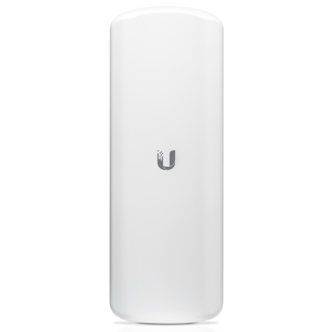
The Ubiquiti LAP-GPS, officially known as the airMAX Lite AP GPS, is an outdoor 5 GHz airMAX AC sector access point designed for wireless ISPs, point-to-multipoint networks and long-distance wireless broadband infrastructure. Its standout feature is GPS synchronization, which helps operators coordinate compatible co-located sectors and make more efficient use of available wireless spectrum. Ubiquiti currently describes the LAP-GPS as a GPS-synchronized sector AP capable of up to 450+ Mbps data throughput.
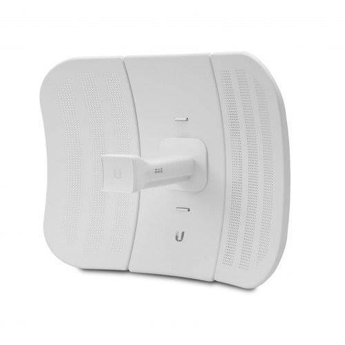
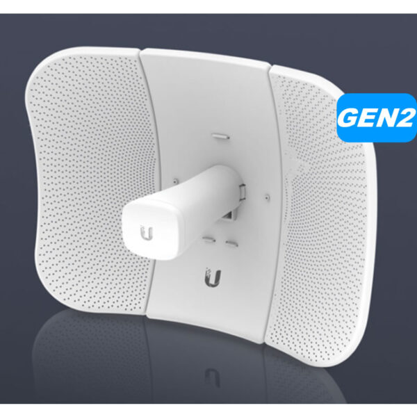
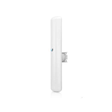
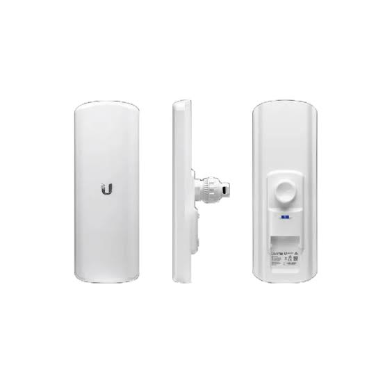
The LAP-GPS combines the radio and a 17 dBi sector antenna in one compact outdoor enclosure. It provides a Gigabit Ethernet connection, operates on 24V passive PoE and supports Ubiquiti's airMAX AC platform. Ubiquiti's dedicated LAP-GPS page specifies a 90° beamwidth, making it particularly suitable for sectorized point-to-multipoint networks where several subscriber radios are located within the same coverage direction.
Unlike an ordinary UniFi access point, the LAP-GPS is not primarily intended to provide Wi-Fi directly to phones and laptops. It is wireless infrastructure: typically, the LAP-GPS operates at a central tower, rooftop or mast and communicates with compatible airMAX subscriber radios at remote buildings or customer premises.
Ubiquiti LAP-GPS Key Features
| Feature | Specification |
|---|---|
| Product | airMAX Lite AP GPS |
| Model | LAP-GPS |
| Wireless Platform | airMAX AC |
| Primary Frequency | 5 GHz |
| Worldwide Radio Range | 5150–5875 MHz, subject to local regulation |
| Antenna Gain | 17 dBi |
| Beamwidth | 90° sector |
| Published Throughput | Up to 450+ Mbps |
| GPS Synchronization | Yes |
| Network Port | 1 × Gigabit Ethernet RJ45 |
| Management Radio | 2.4 GHz |
| Power Method | 24V passive PoE |
| Included Adapter | 24V, 0.3A Gigabit PoE |
| Supported Voltage | 20–27V DC |
| Maximum Consumption | 7.1W |
| Maximum TX Power | 25 dBm |
| Operating Modes | Access Point / Station |
| Cooling | Passive |
| Mounting | Pole |
| Operating Temperature | -40°C to 70°C |
| Wind Survivability | 200 km/h |
| Management Platform | airOS / UISP-compatible environment |
These specifications are based on Ubiquiti's current technical documentation for the exact LAP-GPS model.
5 GHz airMAX AC Wireless
The LAP-GPS uses Ubiquiti's:
airMAX AC
wireless platform.
Ubiquiti currently lists a worldwide supported radio-frequency range of:
5150–5875 MHz
although available frequencies and permitted transmit power depend on the country and regulatory configuration.
The LAP-GPS is therefore designed around the 5 GHz wireless band, rather than 2.4 GHz client Wi-Fi.
For professional installations, the correct country and regulatory settings should always be configured.
17 dBi Integrated Sector Antenna
The LAP-GPS incorporates a:
17 dBi antenna
directly into the device.
This eliminates the need for a separate external sector antenna for a typical installation.
The architecture combines:
Radio
Sector antenna
GPS synchronization
into a single outdoor unit.
This makes the LAP-GPS particularly attractive for smaller WISP towers, micro-POPs and private point-to-multipoint networks where reducing equipment complexity is valuable.
90° Sector Beamwidth
One of the most important differences between the LAP-GPS and LAP-120 is sector width.
Ubiquiti specifies approximately:
90° beamwidth
for the LAP-GPS.
A simplified coverage concept looks like:
             Customer A
                /
               /
              /
         LAP-GPS -------- Customer B
              \
               \
                \
             Customer C

          Approx. 90° sector
Rather than transmitting in every direction, the sector concentrates coverage into a defined area.
This allows network designers to divide a site into multiple sectors where required.
GPS Synchronization
The defining feature of this model is:
GPS Sync
Ubiquiti specifically markets the LAP-GPS around TDMA GPS synchronization.
This is particularly important when multiple compatible sectors are installed at the same tower or nearby locations.
Without synchronization, neighbouring radios can potentially interfere with each other because one sector may be transmitting while another is trying to receive.
GPS synchronization provides a common timing reference that can help compatible radios coordinate their transmission timing.
Why GPS Synchronization Matters
Consider a tower containing several sector radios:
                  Sector A
                     ↑
                     |
        Sector D ← TOWER → Sector B
                     |
                     ↓
                  Sector C
Each sector may serve different customers.
If all radios transmit and receive independently, nearby radios can create significant self-interference.
GPS synchronization can help coordinate compatible airMAX sectors so that transmission and reception periods are better aligned.
The result can be improved:
frequency reuse
network stability
sector coexistence
and potentially:
overall network capacity.
Ubiquiti specifically states that its high-isolation antenna design and GPS synchronization are intended to support greater system capacity and throughput.
GPS Sync Does Not Mean GPS Internet
The GPS functionality should not be misunderstood.
GPS does not:
-
provide internet connectivity
-
determine customer bandwidth
-
replace the 5 GHz wireless connection
-
turn the LAP-GPS into a navigation device
Instead, the GPS receiver provides a highly accurate timing reference used for wireless synchronization.
Ubiquiti's installation guide also specifies that the LAP-GPS requires a:
clear view of the sky for proper GPS operation.
This should be considered when choosing the mounting location.
High-Isolation Antenna Design
Ubiquiti also highlights the LAP-GPS's:
High-Isolation Shielded Antenna
design.
According to Ubiquiti, the design reduces out-of-band energy to improve system capacity and overall throughput in sectorized installations.
This becomes particularly relevant when several radios are installed close together.
The objective is not simply to produce a stronger signal.
It is also to control where radio energy goes and reduce unwanted interaction between sectors.
Up to 450+ Mbps Data Throughput
Ubiquiti currently markets the LAP-GPS as providing:
Up to 450+ Mbps data throughput.
This does not mean every connected subscriber receives 450 Mbps.
In a PtMP deployment, sector capacity is shared among connected stations and real-world performance depends on factors such as:
distance
signal quality
channel width
interference
number of stations
modulation
airtime utilization
traffic patterns
and:
configuration.
The figure should therefore be treated as platform capability rather than a guaranteed subscriber speed.
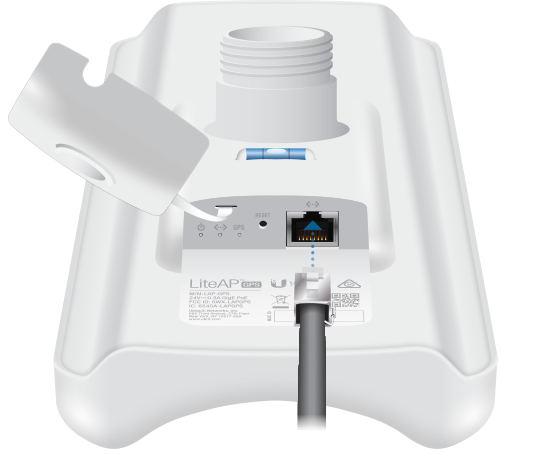
Gigabit Ethernet Interface
The LAP-GPS provides:
1 × Gigabit Ethernet RJ45 port
supporting 10/100/1000 Mbps connectivity.
The port carries network traffic between the radio and the wired LAN.
It also receives passive PoE power.
A typical installation looks like:
Internet
   ↓
Router
   ↓
Network Switch
   ↓
PoE Injector
   ↓
Outdoor Ethernet Cable
   ↓
LAP-GPS
The Gigabit interface avoids the 100 Mbps Ethernet limitation found on some older outdoor wireless devices.
24V Passive PoE
The LAP-GPS uses:
24V Passive PoE
rather than conventional IEEE 802.3af/at PoE.
Ubiquiti specifies:
Pins 4,5 = positive
Pins 7,8 = return.
This distinction is important.
A switch labelled "PoE" is not automatically compatible with the LAP-GPS.
Always verify:
voltage
PoE type
and:
pinout
before connecting an alternative power source.
Included Gigabit PoE Adapter
Ubiquiti includes a:
24V, 0.3A Gigabit PoE adapter
with the LAP-GPS.
The package contents also include:
-
LiteAP GPS
-
ball-joint mount
-
metal strap
-
Gigabit PoE adapter with mounting bracket
-
power cord
according to Ubiquiti's current installation guide.
7.1W Maximum Power Consumption
The LAP-GPS is relatively power efficient.
Ubiquiti specifies:
7.1W maximum power consumption.
This can be useful for remote installations where available power is limited.
It can also simplify appropriately engineered solar-powered WISP sites.
However, an off-grid power system needs to account for the entire site, including:
router
switch
multiple radios
monitoring equipment
conversion losses
and:
battery reserve.
25 dBm Maximum TX Power
Ubiquiti specifies maximum transmit power of:
25 dBm.
Actual configured output may need to be lower depending on:
country regulations
frequency
antenna gain
and:
permitted EIRP.
More transmit power is also not automatically better.
Good wireless design depends on balanced links, clean spectrum, suitable antennas and proper signal levels.
2.4 GHz Management Radio

An interesting LAP-GPS feature is its separate management radio.
Ubiquiti specifies a worldwide management-radio range of:
2412–2472 MHz.
This management connection can make initial setup easier when the installer is physically near the radio.
The 2.4 GHz management radio should not be confused with the primary airMAX network.
The actual wireless backhaul operates on:
5 GHz.
airOS Management
The LAP-GPS operates using Ubiquiti's:
airOS
platform.
The LiteAP AC datasheet identifies airOS v8 as the operating system developed for airMAX AC products.
The current technical specifications list functions including:
Bridging
DHCP
Routing
SNMP
SSH
Ping Watchdog
Web server
Traffic shaping
Dynamic ACK
and:
distance adjustment.
These features give WISPs and network administrators considerable control over the wireless link.
Access Point and Station Modes
Ubiquiti currently lists:
Access Point
and:
Station
as supported operating modes.
The most common LAP-GPS deployment is as the:
Access Point side of a PtMP network.
For example:
                     CPE 1
                       /
                      /
Internet → LAP-GPS —— CPE 2
                      \
                       \
                        CPE 3
Each remote CPE can then provide Ethernet connectivity to the remote site.
Point-to-Multipoint Deployment
Ubiquiti specifically illustrates the LAP-GPS as an AP in an:
airMAX AC Point-to-MultiPoint network.
This is one of its strongest applications.
One sector can serve multiple remote subscriber locations positioned within its coverage area.
For example:
                         Home A
                           /
                          /
                         /
Internet → Router → LAP-GPS —— Office B
                         \
                          \
                           \
                         Shop C
Each remote site requires a suitable compatible subscriber/CPE radio.
LAP-GPS for Point-to-Point Links
The LiteAP AC platform also supports:
Long-Range Point-to-Point Link Mode.
Therefore, LAP-GPS can technically participate in PtP configurations.
However, its integrated antenna is designed as a sector.
For a dedicated link connecting only two fixed sites, a narrower directional product such as:
LiteBeam
PowerBeam
NanoBeam
or another appropriate PtP radio may make more sense.
The choice should depend on the link design.
LAP-GPS Is Not a Normal Wi-Fi Access Point
This is one of the most important purchasing distinctions.
The LAP-GPS should not be confused with:
UniFi U6+
UniFi U6 Pro
UniFi U7 Pro
or other client Wi-Fi APs.
The LAP-GPS is primarily:
airMAX wireless infrastructure.
A typical remote setup is:
LAP-GPS
   ↓
5 GHz airMAX link
   ↓
Remote CPE
   ↓
Ethernet Switch
   ↓
UniFi Wi-Fi AP
   ↓
Phones / Laptops
The remote CPE receives the wireless backhaul.
The UniFi AP then provides ordinary Wi-Fi to users.
Channel Width Options
The LiteAP AC platform supports selectable channel widths.
Ubiquiti documents:
Point-to-Point
10 / 20 / 30 / 40 / 50 / 60 / 80 MHz
Point-to-Multipoint
10 / 20 / 30 / 40 MHz.
The current technical page also identifies proprietary 30, 50 and 60 MHz channel capabilities.
Channel width should be chosen according to available spectrum and network requirements.
Wider is not automatically better.
Wider vs Narrower Channels
A wider channel can provide greater potential throughput.
For example:
40 MHz
may offer greater capacity than:
20 MHz
under suitable RF conditions.
However, wider channels consume more spectrum and may be harder to use effectively in congested environments.
Narrower channels can sometimes provide better:
frequency reuse
noise tolerance
and:
sector planning.
WISP networks should therefore select channel width as part of an overall frequency plan.
Automatic Channel Selection
Ubiquiti's LiteAP AC platform includes:
Automatic Channel Selection.
This can simplify configuration.
However, networks containing multiple sectors and towers often benefit from deliberate RF planning.
Automatic selection should not replace a proper frequency strategy for a larger WISP network.
airView Spectrum Analyzer
The platform also includes:
airView Spectrum Analyzer
among its diagnostic tools.
Spectrum analysis helps installers understand RF activity around the deployment.
It can assist with identifying:
busy frequencies
interference
and:
potentially cleaner channels.
This becomes particularly important in urban environments where 5 GHz spectrum can already contain numerous wireless links.
QoS and Traffic Shaping
Ubiquiti's current specifications include:
WMM packet classification
with:
High
Medium
and:
Low
user-level priorities.
Traffic shaping with burst support is also listed.
These features can assist WISPs and private network administrators in managing network traffic.
Compact Outdoor Design
The LAP-GPS measures approximately:
361 × 129.6 × 71.3 mm
and weighs:
752 g.
This integrated design combines the radio, sector antenna and GPS functionality without requiring a large separate antenna assembly.
The relatively compact footprint can be useful for:
rooftops
small towers
micro-POPs
and:
pole-mounted wireless sites.
Pole Mounting
The package includes:
Pole mounting hardware
including a ball-joint mount and metal strap.
The adjustable mount helps installers set the correct:
azimuth
and:
downtilt/elevation.
Even with a 90° sector, accurate orientation matters.
The antenna should be aimed toward the intended subscriber area rather than simply mounted toward the general horizon.
Clear View of the Sky for GPS
Because GPS synchronization is a major feature, mounting location matters.
Ubiquiti explicitly lists:
Clear view of the sky for proper GPS operation
as an installation requirement.
Installing the unit where the GPS receiver is heavily obstructed by structures may undermine this feature.
This should be considered when placing equipment behind rooftops, walls or other tower infrastructure.
Wind Survivability
Ubiquiti rates the LAP-GPS for:
200 km/h wind survivability
with wind loading of:
77 N at 200 km/h.
This does not mean every mounting pole or tower automatically has the same rating.
The supporting structure, brackets and fasteners must also be properly engineered.
Outdoor Operating Temperature
The LAP-GPS is rated for:
-40°C to 70°C
with:
5–95% non-condensing humidity.
This broad environmental range supports outdoor deployments in many climates.
Correct weatherproof cabling and installation practices remain important.
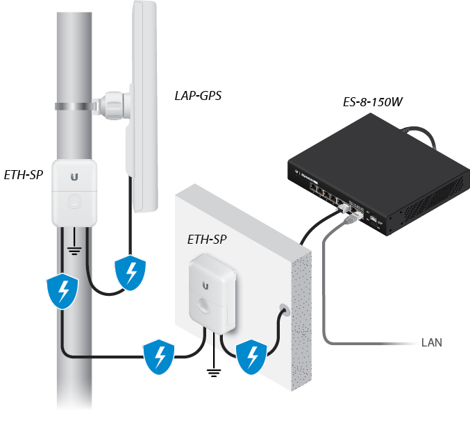
Surge Protection and Grounding
Outdoor radios are exposed to electrical and environmental risks.
Ubiquiti's installation guide recommends:
shielded Category 5 or higher Ethernet cabling
and states that outdoor installations should use surge protection.
Ubiquiti specifically recommends Ethernet surge protectors near:
the LiteAP
and:
the building entry point.
A PoE injector by itself should not be treated as a complete lightning-protection solution.
LAP-GPS for Wireless ISPs
The LAP-GPS is especially relevant to:
WISPs – Wireless Internet Service Providers
A provider can install a LAP-GPS on a tower and serve multiple subscribers.
For example:
                       Customer 1
                          /
                         /
                        /
Internet → Core → LAP-GPS —— Customer 2
                        \
                         \
                          \
                       Customer 3
Each customer installs a compatible CPE directed toward the sector.
The CPE then connects to the customer's indoor router.
LAP-GPS for Multiple Tower Sectors
GPS synchronization becomes especially valuable when several sectors operate from the same site.
For example:
                    LAP-GPS A
                        ↑
                        |
        LAP-GPS D ← TOWER → LAP-GPS B
                        |
                        ↓
                    LAP-GPS C
Instead of using one broad omnidirectional antenna, the operator can divide coverage into sectors.
Each sector can serve a different geographic area.
GPS synchronization can then assist compatible radios in coordinating their transmission timing.
Frequency Reuse with GPS Synchronization
Spectrum is a limited resource.
If a WISP has multiple sectors, assigning completely different frequencies to every sector may quickly consume available spectrum.
GPS synchronization can support more efficient frequency reuse in appropriately engineered networks.
The principle is particularly valuable where:
several sectors are co-located
many subscribers are connected
and:
available clean spectrum is limited.
It does not eliminate interference automatically; antenna isolation, channel planning and installation design remain important.
LAP-GPS for Estates and Compounds
Private networks can also use the LAP-GPS.
For example:
                         Gate
                          /
                         /
Main Office → LAP-GPS —— Warehouse
                         \
                          \
                         Staff Housing
Each remote location receives the wireless link using an appropriate CPE.
This can reduce the need for trenching fibre across a large property.
LAP-GPS for Farms
A large farm may have several remote buildings within the same general direction from the main network.
The LAP-GPS can form the central sector serving:
farm offices
stores
staff housing
gatehouses
CCTV locations
and:
remote facilities.
Line of sight and Fresnel clearance should still be evaluated for every remote station.
LAP-GPS for Schools and Campuses
A campus could use a sector architecture such as:
                         Library
                           /
                          /
Admin Block → LAP-GPS —— Dormitory
                          \
                           \
                         Gatehouse
The wireless bridge carries network traffic to each building.
A conventional Wi-Fi AP can then provide local wireless access inside each remote building.
LAP-GPS for CCTV Backhaul
The LAP-GPS can also form the central radio in a multi-site CCTV network.
CCTV Site A → CPE \
CCTV Site B → CPE  \
                    LAP-GPS → Main Network → NVR
CCTV Site C → CPE  /
CCTV Site D → CPE /
This can be useful for:
industrial compounds
farms
schools
construction sites
parking areas
and:
large commercial properties.
The design should account for the combined video bitrate from all remote locations.
LAP-GPS for Hotels and Resorts
Hotels and resorts can have buildings spread across a wide property.
Potential remote sites include:
cottages
conference facilities
gatehouses
restaurants
staff areas
and:
security locations.
A sectorized wireless network can provide backhaul where installing new fibre is difficult.
Using LAP-GPS with Starlink
A Starlink connection can feed the LAP-GPS through the local network.
Starlink
   ↓
Router / Gateway
   ↓
Switch
   ↓
PoE
   ↓
LAP-GPS
 ↙  ↓  ↘
CPE CPE CPE
 ↓   ↓   ↓
Remote Networks
The LAP-GPS distributes the available network connection.
It does not increase Starlink's internet bandwidth.
Using LAP-GPS with Fibre Internet
A fibre connection could use:
Fibre ONT
   ↓
Router / Firewall
   ↓
Switch
   ↓
LAP-GPS
   ↓
Remote CPEs
The upstream WAN technology does not need to be Ubiquiti.
The LAP-GPS handles the wireless infrastructure portion of the network.
Using LAP-GPS with MikroTik
MikroTik equipment can handle routing while Ubiquiti handles the wireless sector.
For example:
Internet
   ↓
MikroTik Router
   ↓
Switch
   ↓
LAP-GPS
   ↓
airMAX Subscriber Radios
This is a perfectly reasonable multi-vendor architecture when properly configured.
Using LAP-GPS with TP-Link
The wired network can similarly contain TP-Link equipment.
For example:
LAP-GPS
   ↓ Wireless
airMAX CPE
   ↓
TP-Link Switch
   ↓
TP-Link Access Points
The main compatibility requirement on the wireless side is between the airMAX devices forming the link.
LAP-GPS vs LAP-120
These two models are closely related but have important differences.
| Feature | LAP-GPS | LAP-120 |
|---|---|---|
| Wireless Platform | airMAX AC | airMAX AC |
| Frequency | 5 GHz | 5 GHz |
| Antenna Gain | 17 dBi | 16 dBi |
| Sector Width | 90° | 120° |
| GPS Synchronization | Yes | No |
| Gigabit Ethernet | Yes | Yes |
| Passive PoE | Yes | Yes |
| Max Consumption | 7.1W | 8W |
| Main Application | Synchronized PtMP sectors | Broad PtMP sector |
| Management | airOS | airOS |
The LAP-120 covers a wider 120° sector, while the LAP-GPS provides a narrower 90° sector plus GPS synchronization. Ubiquiti's current specifications confirm the LAP-GPS's 17 dBi antenna and GPS capability.
For a simple isolated sector, the LAP-120 may be sufficient.
For a WISP deployment involving several co-located sectors where synchronization and frequency reuse matter, the LAP-GPS offers a significant architectural advantage.
LAP-GPS vs LiteBeam 5AC
| Feature | LAP-GPS | LiteBeam 5AC |
|---|---|---|
| Main Role | PtMP sector AP | CPE / PtP |
| Antenna | Sector | Highly directional |
| Antenna Gain | 17 dBi | Higher directional gain |
| GPS Sync | Yes | No |
| Ethernet | Gigabit | Gigabit |
| airMAX AC | Yes | Yes |
These devices can serve complementary rather than competing roles.
For example:
LAP-GPS
    ↓
Wireless PtMP
    ↓
LiteBeam CPE
    ↓
Customer Router
The sector serves multiple customers while each directional CPE points back toward the sector.
LAP-GPS vs PowerBeam
A PowerBeam uses a narrow directional dish architecture.
The LAP-GPS uses a sector antenna.
Therefore:
LAP-GPS → one central site serving multiple remote stations
while:
PowerBeam → highly directional CPE/PtP applications
is a useful general distinction.
The correct choice depends on the topology.
LAP-GPS vs Rocket Prism + Sector Antenna
A Rocket Prism system uses a separate radio and antenna architecture, which can provide greater flexibility for higher-end sector deployments.
The LAP-GPS integrates the radio and antenna into one compact unit.
That makes LAP-GPS attractive where the priorities include:
lower equipment complexity
lightweight installation
GPS synchronization
and:
cost-effective sector deployment.
More demanding WISP networks may still choose other Ubiquiti sector architectures depending on capacity and RF requirements.
Advantages of Ubiquiti LAP-GPS
The biggest advantage is GPS synchronization. For operators deploying several compatible sectors, synchronized transmission timing can support better spectrum reuse and reduce self-interference problems associated with co-located radios.
The integrated 17 dBi sector antenna also avoids the need to combine a separate radio and antenna. With a single Gigabit Ethernet connection and passive PoE powering, the installation remains relatively straightforward.
Finally, the LAP-GPS combines this architecture with Ubiquiti's published 450+ Mbps throughput capability, airMAX AC protocol and airOS management tools, making it particularly attractive for cost-conscious WISP and private wireless infrastructure projects.
Limitations of Ubiquiti LAP-GPS
The LAP-GPS is specialized equipment rather than an ordinary Wi-Fi AP. Users who simply need Wi-Fi coverage for phones, laptops and tablets should normally consider UniFi access points instead.
Its 5 GHz performance is also dependent on line of sight, Fresnel clearance and RF conditions. GPS synchronization improves network coordination but cannot compensate for a badly obstructed path or poor antenna placement.
The device also uses 24V passive PoE, so power compatibility must be checked carefully when using third-party switches or alternative injectors.
Ubiquiti LAP-GPS Price in Kenya
The price of the Ubiquiti LAP-GPS in Kenya can vary with stock availability, exchange rates, shipping, supplier source and warranty arrangements.
A complete deployment may also require:
subscriber CPE radios
outdoor Ethernet cable
surge protection
network switches
routers
mounting infrastructure
and:
professional installation and configuration.
Contact Orbitlink Solutions for the current Ubiquiti LAP-GPS price and stock availability in Kenya.
Why Buy Ubiquiti LAP-GPS from Orbitlink Solutions?
Choosing the LAP-GPS should be based on the overall wireless design rather than GPS synchronization alone. The sector direction, remote subscriber locations, expected aggregate traffic, available frequencies, interference and line-of-sight conditions should all be considered before installation.
The LAP-GPS becomes particularly valuable where several sectors operate from the same tower or wireless site. In these environments, its combination of GPS synchronization, 90° sector coverage, 17 dBi antenna and airMAX AC provides tools for designing a more coordinated PtMP network.
Orbitlink Solutions can help match the LAP-GPS with suitable airMAX subscriber radios, PoE equipment, outdoor Ethernet cabling, switches, routers and related wireless-network infrastructure.
Watch the Ubiquiti LAP-GPS Video
The LAP-GPS is particularly compelling for sectorized WISP deployments because its GPS capability addresses a problem that becomes increasingly important as wireless networks grow: coordinating multiple radios operating from the same infrastructure. Rather than treating every sector as an independent radio, synchronized sectors can operate according to a common timing reference, helping operators design more efficient frequency-reuse strategies.
Its 90° sector pattern also provides a useful balance between coverage and sectorization. Four appropriately designed 90° sectors can conceptually divide a 360° service area, although real deployments require careful consideration of antenna patterns, overlap, tower geometry, frequencies and interference. The antenna pattern should never be interpreted as a perfectly sharp 90° boundary.
The LAP-GPS should therefore be considered part of a complete wireless system. Subscriber CPE selection, antenna alignment, signal levels, channel planning, Fresnel clearance, cabling, surge protection and network capacity all influence the final result. A well-designed PtMP network can benefit considerably from GPS synchronization, but synchronization does not replace good RF engineering.
Frequently Asked Questions About Ubiquiti LAP-GPS
What is Ubiquiti LAP-GPS?
The LAP-GPS is a 5 GHz airMAX AC sector access point with a 17 dBi antenna and integrated GPS synchronization.
What is LAP-GPS mainly used for?
It is primarily designed for point-to-multipoint wireless broadband networks, particularly WISP sector deployments.
Does LAP-GPS have GPS?
Yes. Integrated GPS synchronization is one of its defining features.
What does GPS do on LAP-GPS?
GPS provides precise timing that can be used to synchronize compatible wireless sectors. It is not used to provide internet connectivity.
Does GPS synchronization reduce interference?
It can help reduce self-interference problems and improve frequency reuse in appropriately designed synchronized networks. Antenna isolation and RF planning are still necessary.
Does LAP-GPS require a view of the sky?
Yes. Ubiquiti specifies a clear view of the sky for proper GPS operation.
What frequency does LAP-GPS use?
The primary airMAX radio operates in the 5 GHz band, with worldwide hardware support listed from 5150 to 5875 MHz subject to local regulations.
What is the LAP-GPS antenna gain?
17 dBi.
What is the LAP-GPS sector angle?
Ubiquiti specifies 90° beamwidth coverage.
What is the maximum throughput?
Ubiquiti advertises up to 450+ Mbps data throughput. Actual throughput depends on the deployment.
Does LAP-GPS have Gigabit Ethernet?
Yes. It has one 10/100/1000 Mbps Ethernet port.
What PoE does LAP-GPS use?
It uses 24V passive PoE, with a supported input range currently listed as 20–27V DC.
Is the PoE adapter included?
Yes. Ubiquiti specifies a 24V, 0.3A Gigabit PoE adapter in the package.
How much power does LAP-GPS consume?
Ubiquiti specifies a maximum of 7.1W.
What is its maximum transmit power?
The published maximum TX power is 25 dBm, subject to regulatory limits.
Does LAP-GPS have a management radio?
Yes. Ubiquiti lists a separate 2.4 GHz management radio.
Is LAP-GPS a UniFi access point?
No. It is an airMAX/UISP wireless infrastructure product, not a conventional UniFi client Wi-Fi AP.
Can phones connect directly to LAP-GPS?
It is not intended to provide conventional Wi-Fi service directly to phones and laptops. Typically, an airMAX CPE receives the link and a separate Wi-Fi AP serves local clients.
Can LAP-GPS be used for PtMP?
Yes. This is one of its primary intended applications.
Can LAP-GPS be used for PtP?
Yes. The LiteAP AC platform supports long-range PtP mode, although a narrower directional radio may be more appropriate for many dedicated PtP links.
Can LAP-GPS work with Starlink?
Yes. It can distribute network connectivity downstream of Starlink to compatible remote airMAX stations. It does not increase Starlink bandwidth.
Can LAP-GPS work with MikroTik routers?
Yes. MikroTik can provide routing and firewall functions while the LAP-GPS provides the airMAX wireless sector.
Can LAP-GPS work with TP-Link switches?
Yes, on the Ethernet side. The airMAX wireless side requires suitable compatible wireless equipment.
What is the difference between LAP-GPS and LAP-120?
The LAP-GPS has GPS synchronization, a 17 dBi antenna and approximately 90° sector coverage. The LAP-120 uses a broader 120° sector, has 16 dBi gain and lacks the LAP-GPS's integrated GPS synchronization.
Is LAP-GPS weather resistant?
It is designed for outdoor use and is rated for -40°C to 70°C operation and 200 km/h wind survivability. Appropriate cabling, grounding and mounting are still required.
How many clients can LAP-GPS support?
There is no single guaranteed client count in Ubiquiti's current specification. Practical capacity depends heavily on traffic demand, RF conditions, signal quality, channel width and network design.
How far can LAP-GPS reach?
There is no universal guaranteed distance. Performance depends on the subscriber CPE, line of sight, Fresnel clearance, interference, antenna height, frequency, permitted transmit power and desired throughput.
What is the Ubiquiti LAP-GPS price in Kenya?
Contact Orbitlink Solutions for the current price and stock availability.
Buy Ubiquiti LAP-GPS in Kenya
The Ubiquiti airMAX Lite AP GPS is particularly suited to wireless operators and private networks that need more than a simple outdoor access point. Its combination of 5 GHz airMAX AC, GPS synchronization, 17 dBi sector antenna, 90° coverage, Gigabit Ethernet and 450+ Mbps advertised throughput makes it especially relevant to coordinated PtMP sector deployments.
For larger installations, the LAP-GPS should be deployed as part of a planned RF architecture. Sector orientation, subscriber locations, frequencies, channel widths, GPS visibility, line of sight, Fresnel clearance and aggregate bandwidth demand should all be evaluated before installation.
Contact Orbitlink Solutions
Orbitlink Solutions
Lyric House, 7th Floor, Room S9, Kimathi Street, Nairobi
Call / Text / WhatsApp: +254 743 720 551
Email: info@orbitlinksolutions.co.ke
Alternative Email: orbitlinksolutions@gmail.com
Opening Hours: Monday–Saturday, 9:00 AM–6:00 PM
Availability: Nairobi pickup and nationwide delivery
Contact Orbitlink Solutions for the current Ubiquiti LAP-GPS price in Kenya, stock availability and assistance selecting compatible airMAX CPEs, PoE equipment, outdoor Ethernet cabling, routers, switches and related wireless networking equipment.
Need Help Choosing? Ask a Technician
Get guidance on setup, compatibility, stock, and delivery before buying for your project.